
These freeways were brutal on the xt225. The speed limit was 80 or 85. I again was wide open throttle for miles, with prius's and double trailer semis passing me. The changes in jetting helped a ton in making the bike work properly, the air filter was finally dry, but the bike still had a top speed of 70. The discussion about a new bike sprung up again. Maybe a CSC Rx3 wouldn't be such a bad idea.... 88 on the speedometer, fuel injection... The other side of the argument was that 88 was just the speedometer, and the actual top speed might not be much faster than the xt; and it still felt wide for my body. We had lots of time to think and talk over the next few days.
It wasn't too far, however, before we found our route. We were headed in to Nine Mile Canyon, I believe. It may have been Argyle Canyon. It is known for petroglyphs. I was noticing that as many valleys as there are in Nevada, each with their own name, there were canyons in Utah, each with their own name. We saw a minivan stopped on the road, I spotted the petroglyphs as we went around the minivan, but we decided not to stop. After a long day of chores and not riding, it felt too good to be going again!
Obviously that doesn't last long with me. I started taking pictures.


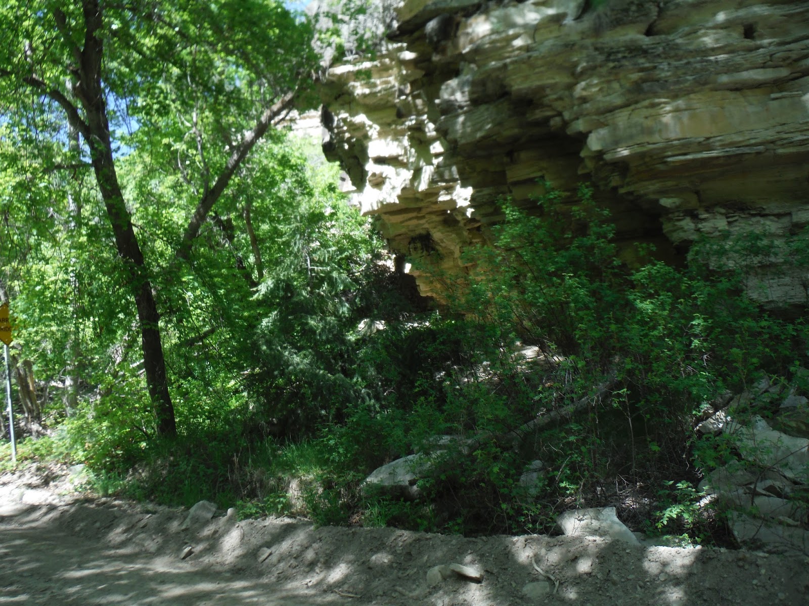
I spotted these by the side of the road... I couldn't tell you if they were ancient petroglyphs or a kiddo who went out and carved on a wall, but it was fun to see.


We made our way into Ashley National Forest, and looked for a spot to camp.

We found one a little way off the road, and check this out! Someone had cut and stacked firewood for us! This was obviously our spot.


I was pretty fascinated by the orange moss... Because when I took the photo, it looked like I used a orange filter, but I didn't! It really looked just like that!


The next morning, though freezing, was bright and sunny! We saw some other dual sports heading down the road. We waved, they waved, and we started packing up our tent. We set off.


It wasn't long before we ran into some snow drifts. We had a super fun time riding through (and sometimes around) the drifts. I was super pleased later, when we ran into the same four guys at a different camp site, and found out they had pushed their bikes through. On this leg of the journey, we rode it all!


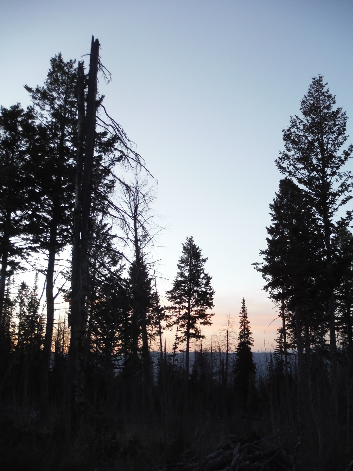
We descended in elevation, and got away from the snow. It was amazing how different this part of Utah was from the red rock we'd been spending so much time in.


We actually got off route and took this beautiful cliff side road. This was near Strawberry Valley and Strawberry River. It was 99% fun and 1% nerve wracking.... The road was quite tiny, barely a lane, and the cliff in parts was quite steep. This was a good photo spot, as it was a little less steep. The views were stunning.


We crossed this little river a bit back; I forgot to get a photo, it was so much fun to cross! This is the Strawberry River.


We passed a little resorts named "Camelot." It was interesting riding in more populated areas again. If there was a resort, we must not be too far from civilization, yet we were just far enough away to be enjoying dirt roads and isolation.


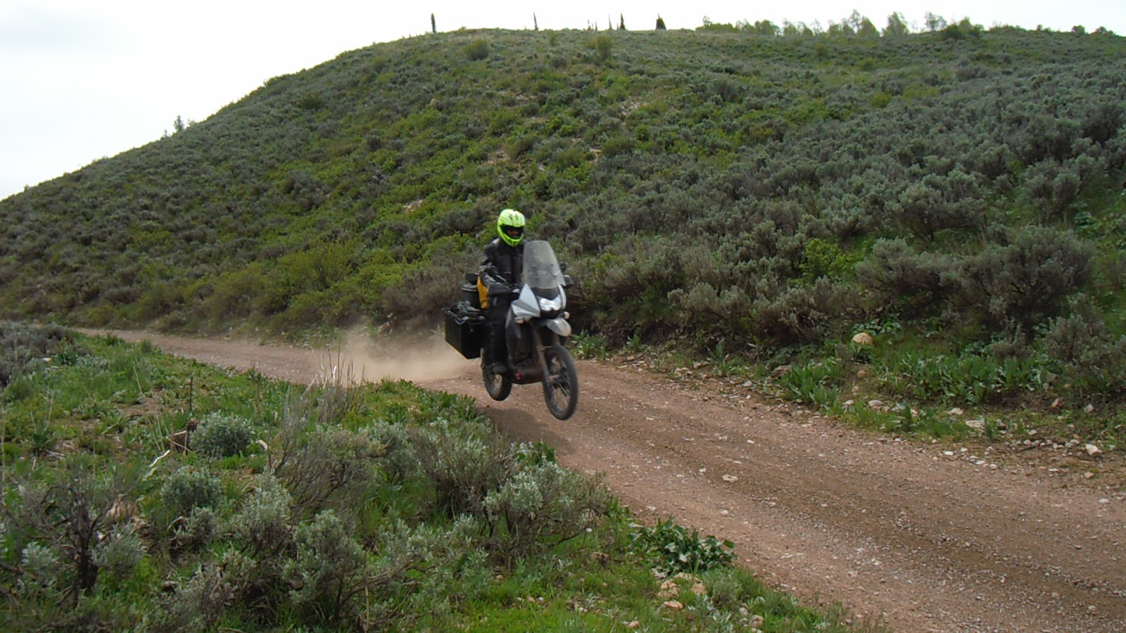
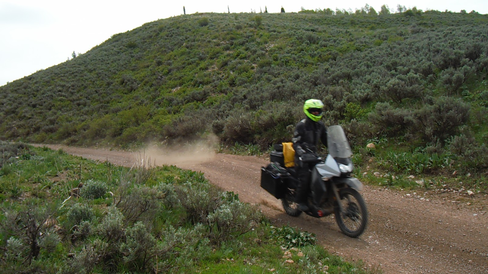
Around this time, Nathan found a sweet jump in the road. He thought it would be cool to get a picture jumping a fully loaded KLR. Now, my camera has a feature where you can take action shots. But it's not a feature I use often, so I forget how to use it between times. It took him repeating the jump 3 times (I'm sure he was oh so disappointed about this) but check it out...


We followed this road to pavement into Fruitland, UT, and got gas and lunch at "The G Spot." It was a great little place, and I had to get a hoodie. We met some super helpful guys that asked about our trip and where we were headed; they knew people in the DOT, so they asked about our planned route, and found out there was no way no how that we were making the trip that way. They sat down with our map and charted us an pretty route around the highest elevation, and we were on our way.


We took 208 to 35 through Tabiona.... I don't remember the exact route we took, but I believe we hooked up with the BDR again off road, and then it dropped us back on to the road and into Wyoming.


My recollections get a bit fuzzy, so they may be a bit out of order. We really wanted to do all of the north half of the BDR. We were making good progress, when we got to this rushing river. Later in the year, this would have been a lovely little water crossing. But both of us looked at this, and decided this was not a crossing we wanted to risk... we estimated it to be 3-4 feet deep in the center, moving at 25ish mph... This seemed to be a good way to get a bike swept downstream, or at the very least, filling an engine full of water. Time to turn around...


We took a detour to an advanced offshoot. Super fun, until we got to deep snow. Back down to the main route we went. The main route was paved, but still fun. Sort of.... the xt was hating the elevation.


Check out this lake! Look at the cloud reflected in the lake. It was so beautiful and so fun.


We got back into the dirt, and found more snow. Nathan mentioned going to the right, but I went left. Which was downhill. A muddy swampy snowy downhill. It got sticky, I lost momentum, and the bike slowly laid itself down as I tried to stand on slick mud. I couldn't even get it up without falling on my patootie. Luckily, Nathan could.

We found another river crossing, and it was much more reasonable. We also found an advanced area that was not snowed in. I'm not sure which of these photos are from that portion, because I was probably busy keeping the bike on two wheels. I didn't think the advanced area was too challenging, at least at this time of year. It was rocky, but that was it.


We had some fun on the Utah, Wyoming border. What I really enjoyed was that at the beginning of the trip, I was hesitant to ride into the ditches for photos, leaving my bike up on the road, and letting Nathan go into the ditch. Now, it wasn't even a consideration. Easy as pie, my bike was in the ditch and we were taking pictures!


I liked the name of this gas station... last gas station before the Utah Border in Wyoming.


We found a bar called Spanky's, and had to take Spanky there. We just wanted a coke and a snack... we got a coke; turns out bars don't serve food in Evanston.

We looked at our map... two camping options.... 5000 ft or 8500 feet. I voted 5000.
We cruised around the campground and found a dispersed campspot that was also somewhat protected from the wind, and a bit away from the reservoir. Nathan found this rain rut that he thought might be a road. It wasn't.


The next morning, I thought I remembered the bathroom being quite close. On bikes, the road is fast. It was about 3/4 of a mile back to the parking lot. It did give me a lot of time to take pictures!


I think there's a bunny in this one somewhere, but I can't find it at the moment. Good camouflage.


Nathan went to the store for us in the morning; for breakfast and water. We were out of both. At the shop, he talked to them about our desired route. The peak was around 9000 feet; I had been worried about this pass even before our snow experiences. The shop keeper told us there was no way anyone was getting through. Nathan came back and talked to the guys we'd seen ride past us. He found out 1) about them having to push their bikes through the snow drift, and 2) that they hadn't done the water crossing on the other part of the Utah BDR because they'd developed a bike problem. Would I sound snarky if I said BMW's? Ok. I feel snarky. I'll leave it, but refrain from further snarkiness. And hey, they got it fixed and were back on the road, so that's a good sign, right?
We rode the 5-10 miles back to Randolph, where we took a dirt road cutoff. The plan was to take the dirt roads we found on google until we could join back up with the UTBDR.

The shopkeeper warned Nathan "Don't worry about the cows, they'll move if you honk. Worry about the deer; they like to jump in front of you and travel in huge herds."
We saw a whole lotta cows this day. And they did get out of the way if you honked your horn. We had great fun.


The roads got smaller and smaller for a while, and then opened back up to a main road.

More aspen trees!


I wish this photo captured the magic of where we were. We were high in the trees, and you could see the rolling farmland beyond. It was magnificent.

We found some pretty major snow drifts on this route.


We did some scouting, and found pretty much a glacier. So we turned around and decided to try a different road.


Which eventually also became impassable. So we started on what we termed "The Google Backroads Discovery Route."


Google told us to go through this gate. There wasn't a no trespassing sign, so we did.


As we rode, the road again got smaller


and smaller

and smaller. . .

until I hear Nathan saying into his Sena "Turn left where?" There was a clearing with a road somewhere...

After a bit of exploration, he found this...

And we again set off. Google discovery route for the win! Seriously, in that moment, I forgave Google for EVERY RIDICULOUS LAST MINUTE DIRECTION CHANGE AND MISTAKE she has ever given me, because we were officially having the time of our life.


The roads were a hoot. I was glad I'd gotten used to riding with the extra luggage.


Utah's farmlands and backcountry are unspeakably beautiful.


We found more snow, but were headed toward the sunnier side of the mountain, so we just rode through it.


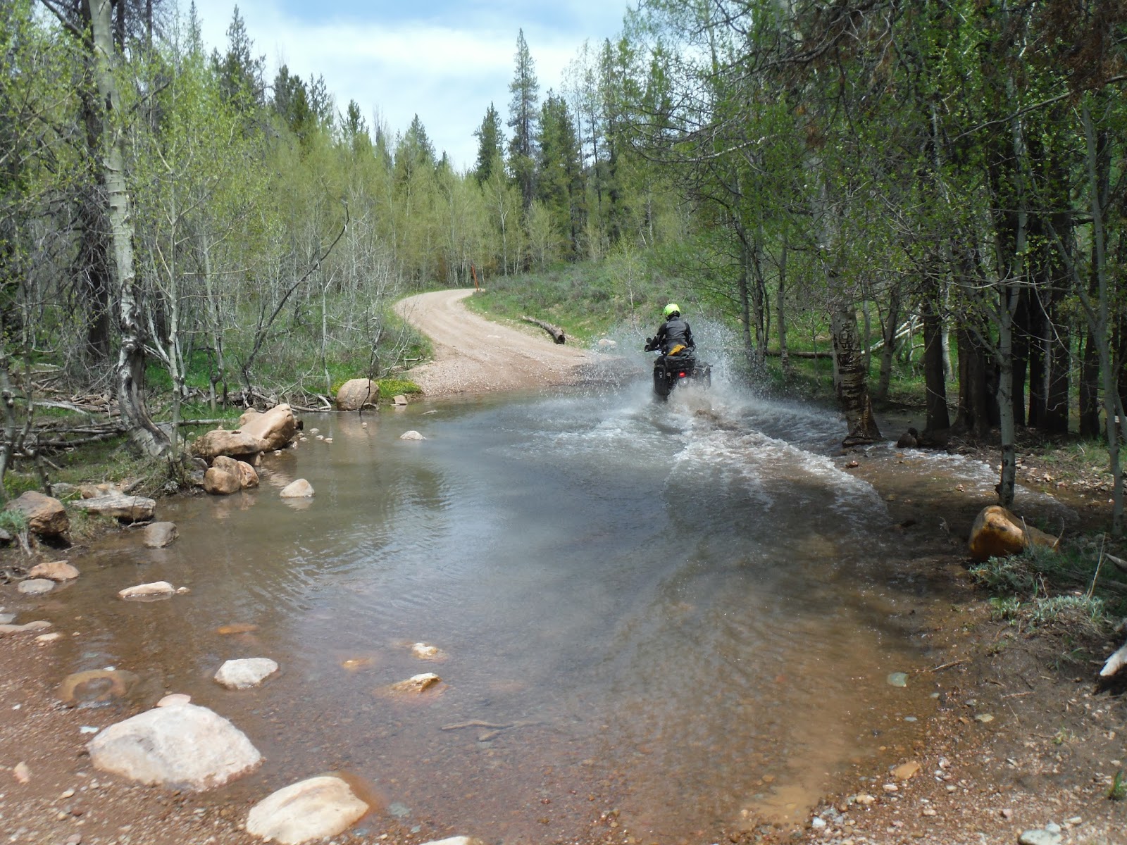
We found ourselves a little water crossing, and Nathan snapped this great photo:

We found a bigger, murkier water crossing... Nathan tested depth just to be sure. It seemed fine on his side, but I liked my line better.


We both took my line.

This was the road of water crossings!

All this adventuring was making us hungry. It was probably around noon or 1. We only had about 10 miles to go to Bear Lake, where we'd been promised the best raspberry milkshakes on the planet. No problem! 10 miles should be a piece of cake.
We knew we had one more pass on the official UTBDR, but had been promised an epic view of Bear Lake if we made it. So when we encountered more snow, we decided to try to make it through and around the snowy patches.


Turns out the XT absolutely loves playing in the snow. Rooster tails half a mile high (exaggerate much Kris?) spinning the back tire to cut paths, we had ourselves some fun

Nathan went on down the road a bit, while I hauled gear over the snow drifts. He was on the KLR, feeling confident in his snow cutting abilities. After he didn't come back, and I didn't get through to him via text (we did have cell service, which was nice) I hopped on the trusty xt and headed through the snow in the direction he'd disappeared.
As it turned out, Nathan had gotten so confident with his D606 that he thought he could ride right through this huge snow drift. Lol... notice there is no person holding that bike. We actually laid it on its side and drug it over to the good rut on the left there.

We spent the next 6 hours trying to go a mile. We tried unloading the bikes and carrying gear through the drifts. Nathan tried taking the xt ahead to see what was next. We'd get a bit of a ways through, carry the gear to the next spot, get the bikes through, carry the gear.... it was a pretty never ending process. Totally fun and worth the adventure though. Until we met some guys on quads. They flew over the top of the snow, and scouted ahead for us... There was indeed an impassible drift ahead. At least that's what they told us.... Nathan went and scouted it on the xt. I hauled the gear back in the direction we were heading, as I'd started hauling it back up the mountain. He was gone forever. But I didn't have a trusty xt to go check on him, and if you've ever seen me mount the KLR, it's a bit like mounting a full sized mustang. He eventually came back, and we admitted defeat. The pass was indeed, impassable. But, no worries, Google to the rescue!
She took us down yet another beautiful forest road, and look! You can see Bear Lake in the distance!

Here we were. Again, I wish photographs could capture the beauty. At this time of the day, the lake was aquamarine. It was slightly less impressive than it would have been had we not been STARVING. I'm sure there would have been many more pictures taken.


There was construction, so I took this quick photo while waiting.
We found an open burger joint, one of the dozen that promised the best raspberry milkshakes in the world, and had them make good on their promise.

Then we cruised up the road to the Bear Lake View Point we'd been promised.


I learned that Bear Lake got it's color because of the bitty pieces of limestone that cover the bottom of the lake? They reflect the colors around it, so the color changes from blue to green to aquamarine. In the time we'd had dinner, it has changed from aquamarine to a deep blue.


I decided to ride my bike into the grass, so I could pretend we'd made it here off road. We actually found where the snow pass ended, and we'd have had to take the street to this point anyway.

A fellow rider stopped off to talk, and offered to take my picture with my bike.

This was the end of the UTBDR. It was incredible, and I'd go back and do the entire route in a heartbeat. We were also drawing close to the end of our adventure... We rode the most incredibly beautiful highway from Garden City to Logan, Ut. It had incredible curves and scenery, probably the most beautiful highway I have ridden. Not the kind of highway where you stop for photos, though, because the riding was way too intensely good. The lower we got in elevation, the happier the bike was. Even with it's new jetting, though it wasn't coughing and sputtering, it got a bit slower where the air was thinner. It had also been quite wobbly since Moab. We'd asked the folks at Moab Powersports to balance the tires, and they said they did, but we were pretty sure they were mistaken. We'd asked in Evanston about tire balancing at the motorcycle store, and, I kid you not, the response was "What's that?" We decided to stay in a motel in Logan for the night, and see if we could find a motorcycle store in the morning that new how to balance tires. Showers, hostess cupcakes, and coke made for a very pleasant evening.
No comments:
Post a Comment